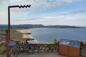
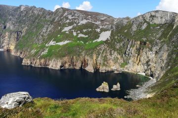
Observers of our current project, the mapping of the Wild Atlantic Way, will have spotted that things are a little delayed. There are a few reasons for this, but one relates to the fact that it is, indeed, a bit Wild in places and that it can be hard to find your Way. As is often the case when planning tasks, we decided to lay down a baseline that included the route itself. Many of us who have visited the west coast will have seen lots of route signs – it should be unambiguous, no?
Attribution: CC-BY-SA Nilfanion – Shuttle Radar Topography Mission Relief data National Geospatial-Intelligence Agency Coastline data File:Ireland location map.svg: NordNordWest Borders
Turns out, not always. We have found quite a bit of variation in assumptions of exactly what way the route goes, and we can’t always tell why, but we have many theories. Some descriptions of the route are quite zoomed out, and may just indicate towns or tourist sites along the route without making clear exactly how to navigate between them. We also wonder whether the route may have been refined over the years, with some sections superseded by others. It’s not uncommon for tourist routes to branch a bit as well, especially in areas where some of the “Wilder” sections may be unsuitable for all vehicles. So while a cyclist may be happy to hug the coast on a rural dual-carriageway (single track boreen with grass down the middle), motor homes may need to stay on nicer roads.
DeBigC and b-unicycling undertook some field research in Cork – if the weather hadn’t been pants, we might have accused them of taking a holiday. They travelled the bulk of the route from Kinsale to the Kerry boundary and found ground truth to be just as confusing in cases. Some junctions were ambiguous and unsigned. Other locations exhibited empty sign-poles of the kind used on WAW signs elsewhere, but the signs were absent (perhaps put away until the rain stopped?). In at least one instance, a sign only loosely coupled to its pole appeared to be pointing the wrong way. It’s still the wild west.
So what do we do? Well, we live and map in Ireland, so we are no strangers to uncertainty. Our plan is to lean into it. One of many OSM mantras is “it’s a wiki”, which roughly translates as “it doesn’t matter if the map is a little wrong for a bit, lots of scrutiny will help fix it quickly enough”. In the best Monty Python principles of “I’m the Wild Atlantic Way and so is my wife”, we will simply give the benefit of the doubt to all contending sections of the route – all will be included until we can exclude any found to have no valid claim. No mapping will go to waste, whether or not it proves to be along a certified section of the WAW. Please bear with us while we try to gear up on that basis to be ready on Monday 31st May. Our travellers shot 50,000+ Mapillary images to help us all see what they saw on their Odyssey. Mapillary is taking some time to process these, apparently due to some database maintenance work, but we hope they will show up soon, so we can harvest their details.
There is a nice upside to all this uncertainty – in a world where nobody can agree where the WAW is and is not, OSM, not for the first time, can benefit from the power of the crowd. We are well placed to arbitrate this uncertainty, and our map will get better the more people use it and critique it.
In the meantime the community has busied itself with fixing, rectifying and splitting the way into seven manageable chunks. Some of the way already had Mapillary images, and some previous mappers made efforts to capture the way based on their own driving, cycling and walking, just like our two intrepid travellers.
We will publish mapping tasks based on the townlands along the way. When this mapping starts next Monday (31st May 2021) the hope is to add as many of the visible amenities, buildings, land uses and natural features along the WAW coast of Ireland. In some instances, tourist businesses may have folded and gone away, while others may have opened, so OpenStreetMap Ireland is helping that reopening.


0 Comments