Uncategorized
OSM Ireland is now an official chapter!!
In 2008 the State of the Map was held in Limerick, Ireland and ever since there have been utters and suggestions that there should be an official local chapter in Ireland. Roll on to State of the Map 2019 and OSM Ireland has now recognised by the Open Street Map Read more…
OSMIE
Let’sEncrypt SSL for Planet.OpenStreetMap.ie subdomain
Further to our ongoing effort, we have now introduced SSL connections to planet.openstreetmap.ie Now you can be sure that your downloads are coming from the OSM Ireland server, https://planet.openstreetmap.ie

Uncategorized
Targets hit this week – 24th May 2016
Well we have finally hit 95% townland coverage for the entire island!! It definitely feels like we are on the home stretch now and will hit 100% coverage in a few months time. The following is a screen-shot from www.townlands.ie And a map showing the areas which have still Read more…

Uncategorized
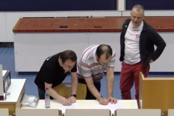
Meet Up – April 2016
OpenStreetMap (OSM) Ireland members will meet Saturday 23rd of April in Dublin and do OSM mappy stuff on laptops in TOG. Like an indoor mapping party / hack day / social meet up / barcamp. If you’d like to learn more about OpenStreetMap, come along! Want to start mapping your Read more…
Townlands
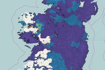
Townland Heat Map
Rory has added a nice heatmap to the townlands.ie website ( http://www.townlands.ie/page/maps/ ) which changes colour based on when the townland was added to the database. The image below shows the state of play on the 27th January 2016.
OSMIE
Targets hit this week – 23rd December 2015
The OSM community have just surpassed the 47,000 townlands mark! Earlier last week http://www.townlands.ie, stopped updating (new townlands stopped appearing as they were added). After an investigation into the problem it was found that the database had grown so much that an upgrade is needed! The administrator (RoryM) Read more…

OSMIE
90 Young mappers and one flabbergasted older one!
My name is Dermot, and I’m a Mapaholic. I started adding bits of Ireland to OpenStreetMap early in 2007 and I haven’t stopped yet. When I started, there were pockets of coverage and a few interurban roads mapped. But basic things like a coastline were still missing. I was immediately bitten Read more…
Townlands
A few targets hit this week – 28th November 2015
Firstly congratulations to Stephen_Co_Antrim on achieving 10,006 townland’s!! Given that there are approximately 64,000 townland’s in Ireland, he has completed about 1/6th of the Island all by himself! Meanwhile townland coverage stands at 45,424 (74.3%) with County Monaghan now 100%, with just County Cavan remaining to complete Ulster.
Uncategorized
Irish Vice Counties
I’ve been meaning to write about OpenStreetMap Ireland‘s townland mapping project for some time. It’s a wonderful example of how historical maps are of significant value in creating really useful data on OpenStreetMap which is just as relevant as it today as was in the past. The immediate reason for Read more…